BC Cycle Tourism Society

bikepacking.com

bikepacking platform Visit bikepacking.com ↗

bikepacking.com is an independently operated, member-supported bikepacking media platform founded in 2012 by Logan Watts. It publishes original and curated bikepacking routes, gear reviews, adventure stories, and planning guides, with a global route network spanning nearly 50 countries, alongside a biannual print magazine, The Bikepacking Journal.

Their BC collection

bikepacking.com's British Columbia routes run from sub-100 km overnighters to multi-week expeditions such as the 1,164 km BC Trail and the roughly 1,046 km Tree to Sea Loop around northern Vancouver Island, with coverage across BC. Its route pages are unusually deep: full logistics (access, resupply, camping, difficulty) and absolutely beautiful photography. It has also singled out the West Kootenay as a destination-level bikepacking region, with a dedicated route network guide centred on Nelson (bikepacking.com/west-kootenay) linking the Kootenay Confluence, Santa Rosa Valleys and Vistas, Bonnington Scrambler, and Frog Peak Loop routes. Terrain is predominantly unpaved gravel and forest service road.
All 33 BC rides#

Open any ride for its welcoming stops and how to get there. The full writeup, map, and directions live on bikepacking.com's website.

Vancouver, Coast and Mountains · 7

Photo: Yvonna ChowMadeira Park, BC
10 Lakes Overnighter, Powell River
103 km · 2357 m up
ChallengingComfortable for mostAlmost all gravelMax climbing

The name says it: this 103 km loop from downtown Powell River strings together ten freshwater lakes on the Sunshine Coast's vast logging-road network, loosely following the famous Powell Forest Canoe Route. Fast-rolling gravel with a handful of steep climbs, and lakeside camping at spots like Nanton Lake and Fiddlehead make it an easy first overnighter. These are active, radio-controlled logging roads, so stay alert for trucks and give them the road.

Stops, map + getting there →
Photo: Heath MoffattVancouver, Coast and Mountains, BC
Bikepacking the Sea to Sky Trail
101 km · 1917 m up
ChallengingCalm streets, some sharingMixed surfaceLots of singletrackLots of climbing

The Sea to Sky Trail runs 101 km from Squamish through Whistler to Pemberton, tracing a corridor the Coast Salish and Interior Salish peoples travelled long before highways. Nearly half is flowy singletrack, and the rest mixes doubletrack, gravel, and pavement past turquoise lakes, swimming holes, suspension bridges, and even an old train wreck. Climbs come short and punchy rather than long. Resupply is easy in all three towns, and public transit can carry you back to the start.

Stops, map + getting there →
Photo: Yvonna ChowEgmont, BC
Lower Sunshine Coast Bikepacking Route
101 km · 3107 m up
EpicComfortable for mostAlmost all gravelLots of singletrackChunky gravelMax climbing

A forty-minute ferry from Vancouver drops you at Earls Cove, where this route dives into a green tunnel of loamy mountain bike trails made famous by the BC Bike Race, wooden stunts and all. Three-quarters of the 101 km is singletrack, with around 3,100 m of climbing, so this is proper technical mountain biking, not a gravel ride. Sechelt sits at halfway for resupply, coffee, and brunch, and swims at Chapman Creek and Crowston Lake break up the effort. A brilliant first bikepacking trip for confident mountain bikers.

Stops, map + getting there →
Photo: Jennifer KleingeltinkAgassiz, BC
Powell River Sampler
84 km · 2008 m up
ChallengingComfortable for mostAlmost all gravelLots of singletrackChunky gravelMax climbing

The Powell River Sampler runs one way from Saltery Bay to Powell River, mixing over 50 km of loamy, ribboned singletrack with easy gravel, past waterfalls, lakes, ocean views, and the bird-rich Duck Lake protected area. Community-built cabins and lakeside campsites make the nights comfortable, and an optional hike-a-bike detour climbs to Walt Hill's 360-degree views. Rooty, technical trails call for real mountain bike skills. It links the Lower Sunshine Coast route with the Comox ferry, so the whole coast chains together.

Stops, map + getting there →
Photo: Andrew StrainPowell River, BC
Powell River Sampler (Alternate Walt Hut Route)
98 km · 2762 m up
ChallengingComfortable for mostAlmost all gravelChunky gravelMax climbing

An alternate version of the Powell River Sampler that builds in the climb to Walt Hill hut: a steep gravel grind and a stretch of hike-a-bike, rewarded with a cozy cabin and 360-degree views over the canoe country and across to Vancouver Island. About 98 km with 2,800 m of climbing, noticeably harder than the standard line.

Stops, map + getting there →
Photo: Hubert KangSquamish, BC
Saw̓pa (Cloudburst Mountain) Divide
81 km · 1451 m up
ChallengingComfortable for mostMostly gravelChunky gravelLots of climbing

An overnight bikerafting loop through Sḵwx̱wú7mesh (Squamish Nation) territory: breakfast at a cafe overlooking the Cheakamus River, gravel up Paradise Valley and over a pass below Saw̓pa (Cloudburst Mountain) with views of Black Tusk and Mount Garibaldi, then a gentle Class II float down the Squamish River past waterfalls and eagle perches back to the start. The route's waypoints carry Indigenous place names from the Squamish Atlas, so you learn the land as you cross it. You will need a packraft and glacial-river respect; the riding itself is mostly straightforward gravel with some rough, steep sections.

Stops, map + getting there →
Photo: Andrew StrainLund, BC
Texada Ridge Runner Route
144 km · 2674 m up
ChallengingComfortable for mostMostly gravelLots of climbing

The Texada Ridge Runner traverses the island's spine from Blubber Bay to Anderson Bay and back, 144 km of quiet gravel past old farmsteads, forgotten airstrips, and beaches, with views across to Vancouver Island and the mainland mountains. The climbing is staggering for an island ride, steep and frequent, so two days is a challenge and three is a holiday. Camp oceanside at Anderson Bay or by Bob's Lake, and enjoy a rare bonus: Texada has no bears. Ferry from Powell River.

Stops, map + getting there →

Vancouver Island · 9

Photo: Pete O HaraPort Alberni, BC
Alberni Bam Bam, Vancouver Island
507 km · 9765 m up
AmbitiousCalm streets, some sharingMostly gravelLots of climbingRemote stretches

A week-long, roughly 500 km loop from Nanaimo around the south island's wild interior: gravel and rough doubletrack through the Cowichan Valley to Port Renfrew, past the Walbran Valley and Fairy Creek rainforests at the heart of BC's old-growth story, then to Bamfield, where the MV Frances Barkley, a 65-year-old heritage ship, carries you four hours up the Alberni Inlet. Swim spots and quirky communities all the way; long stretches without resupply, so plan carefully. Designed to be ridden car-free from the Departure Bay ferry.

Stops, map + getting there →
Photo: Local WandererCobble Hill, BC
Cowichan Valley 8 Bikepacking Route
190 km · 1571 m up
ModerateComfortable for mostMostly gravelSome climbing

A 190 km figure-eight starting and ending at the parliament buildings in downtown Victoria, following the Galloping Goose, Sooke Wilderness Trail, Cowichan Valley Trail, and Lochside Trail through farm and wine country. Mostly gravel and doubletrack with one real climb near Goldstream, it rides comfortably on a gravel bike in a weekend. Note the publisher's caution: the paved stretch between the Kinsol Trestle and the Mill Bay ferry is busy in summer and deserves extra care.

Stops, map + getting there →
Photo: Yvonna ChowParksville, BC
Englishman River Overnighter
52 km · 496 m up
AmbitiousComfortable for mostMixed surfaceLots of singletrackSome climbing

The gentlest introduction to island bikepacking: 52 km out and back from Parksville's beachfront to Englishman River Falls Provincial Park, through mossy rainforest and estuary on multi-use paths and rooty singletrack. Top Bridge's suspension bridge and swimming holes make the perfect halfway stop, and twin waterfalls wait at camp. Logistics are one online campground booking. Front suspension helps on the rootier stretches, but the route forgives.

Stops, map + getting there →
Photo: Kimberley KufaasPort McNeill, BC
Jeune Landing Loop
134 km · 2128 m up
AmbitiousComfortable for mostAlmost all gravelLots of climbing

A 134 km figure-eight linking Port McNeill and Port Alice on the North Island's rolling gravel, one of the island's most approachable bikepacking routes: no singletrack, gentle climbs, and lakeside rec-site camping all along. The country is karst, and the route passes the Devil's Bath, one of Canada's largest cenotes, and the Eternal Fountain's disappearing waterfall. A cafe in Port Alice marks halfway. The local campground reckons bikepackers are now a fifth of its guests; this is why.

Stops, map + getting there →
Photo: Jarrett LindalCumberland, BC
Snowden or Dust, Vancouver Island
75 km · 1106 m up
ChallengingComfortable for mostAlmost all gravelLots of singletrackLots of climbing

A 75 km overnighter from Campbell River built around the Snowden Demonstration Forest's 100 km of trails: over 40% of the route is singletrack, flowy and sometimes rocky, linked by scenic gravel with lakeside rec-site camping to choose from. Designed as a mountain biker's introduction to bikepacking; bring decent trail skills, a hardtail, and your navigation patience, because the trail network is a maze. Not a gravel-bike route.

Stops, map + getting there →
Photo: Abby CooperTofino, BC
Strathcona Dam Detour
11 km · 267 m up
ChallengingComfortable for mostAlmost all gravelMax climbing

An 11 km unpaved detour on the Tree to Sea Loop near the Strathcona Dam northwest of Campbell River. With public access across the dam closed, this ride-around on the north side of Campbell Lake is the current standard line; short, hilly, and all gravel.

Stops, map + getting there →
Photo: Graeme OwsianskiTofino, BC
The South Island Sundowner
139 km · 1317 m up
ChallengingComfortable for mostMostly gravelSome climbing

A 139 km loop that never strays far from Victoria yet delivers a real taste of the island's ruggedness: rail trail and fire roads link steep, loose climbs through Thetis Lake and Francis King parks, remote singletrack in the Sooke Hills, and wide views over the Strait of Juan de Fuca to the Olympic Mountains. The numbers look tame, but a couple of kilometres of rocky hike-a-bike and relentless 20% pitches earn its reputation. Cafes and swimming lakes reward a three-day pace; strong riders chase the sundown in two.

Stops, map + getting there →
Photo: Garry HenkelCampbell River, BC
Tree to Sea Loop, Vancouver Island
1046 km · 16742 m up
EpicCalm streets, some sharingMostly gravelLots of climbingRemote stretches

The North Island's bucket-list epic: a roughly 1,046 km gravel loop from Comox linking massive valleys, deep fjords, and coastal villages, Gold River, Tahsis, Zeballos, Port Alice, Holberg and its famously remote pub, on a patchwork of forest service roads. Along the way: whale watching, caves, and some of BC's best waterside camping. Plan on 15 days, a water-taxi leg from Tahsis to Zeballos, unreliable village resupply, and weather that can turn any season. Note the 2026 Strathcona Dam closure reroutes the early kilometres around Campbell Lake.

Stops, map + getting there →
Photo: Boomer JerrittCampbell River, BC
Tree To Sea Mini
384 km · 6112 m up
ChallengingCalm streets, some sharingMostly gravelLots of climbingRemote stretches

The approachable version of the island's epic: a 384 km loop from Campbell River following much of the full Tree to Sea route while skipping the Tahsis-to-Zeballos boat charter and taking a more direct line to Gold River. Still a serious ride, mostly gravel with over 6,000 m of climbing and long remote stretches, but a fine introduction for riders short on time or working up to the full thousand.

Stops, map + getting there →

Thompson Okanagan · 4

Photo: Andrew StrainKamloops, BC
BC Grasslands Circuit
250 km · 4054 m up
AmbitiousCalm streets, some sharingMostly gravelLots of climbing

A three-day, 250 km loop through the fragile grassland ecosystems south of Kamloops: just one percent of BC's land base, yet home to nearly a third of its threatened species. The route rolls past sprawling historic ranches, including Canada's largest at Douglas Lake, and azure lakes teeming with waterfowl; bring binoculars, this is some of the best birdwatching in the province. Good gravel and quiet pavement, but the climbs are real, around 4,000 m in all, and water is scarce, so carry plenty.

Stops, map + getting there →
Photo: Thompson Okanagan Tourism AssociationKelowna, BC
Chute Lake Charcuterie Route, Kelowna
103 km · 1690 m up
AmbitiousComfortable for mostMostly gravelRough, near-MTBLots of climbing

Kelowna's introduction to bikepacking: climb out of the city on the Mission Creek Greenway and Myra-Bellevue's singletrack to the Kettle Valley Rail Trail, spend the night at Chute Lake, in the lodge's glamping tents or the free rec site next door, then descend flowy trails back to City Park. The KVR stretch runs sandy and potholed, so a mountain bike is happiest. Beaches, restaurants, and breweries wait downtown when you roll back in.

Stops, map + getting there →
Photo: Andrew StrainKamloops, BC
Lac du Bois Tranquility, Kamloops
229 km · 4207 m up
ChallengingComfortable for mostMostly gravelChunky gravelLots of climbingRemote stretches

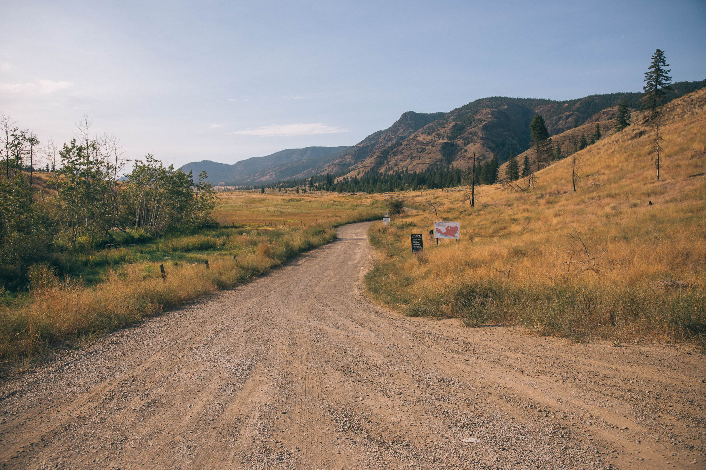
North of Kamloops lies a maze of scenic gravel through grasslands, mossy forest, and deep canyons that could be straight out of a Western. This 229 km loop through the Lac du Bois Grasslands climbs to Vidette Lake and back over three to four days, past forgotten homesteads, the Castle Rock Hoodoos, and country thick with stories, from Sasquatch sightings at Red Lake to gold panning on the Tranquille River. Long steep climbs, exposed heat, and no resupply, so carry water and take your time. Lakeside rec sites make camping easy.

Stops, map + getting there →
Photo: Kari MedigKimberley, BC
The BC Trail
1164 km · 16531 m up
EpicComfortable for mostMostly gravelChunky gravelLots of climbing

The flagship BC traverse: about 1,164 km from Cultus Lake to Fernie following the province's spine of decommissioned rail trails, the Coquihalla River Trail, the KVR with its Myra Canyon trestles, and the Great Northern, linked by forest roads and occasional rocky singletrack. Rail grade does not mean easy: many sections run rough, sandy, and washboarded, hard on gear and riders alike. Plan on about 12 days, with good town amenities between the remote stretches. The BC Epic 1000 race follows it from Merritt to Fernie every June. Note: the Hope to Princeton rail trail closure currently reroutes that section via Tulameen.

Stops, map + getting there →

Kootenay Rockies · 8

Photo: Kari MedigNelson, BC
8 Rivers Overnighter
206 km · 3251 m up
ChallengingCalm streets, some sharingAlmost all gravelChunky gravelLots of climbingRemote stretches

Tucked into the East Kootenays in Ktunaxa and Secwepemc territory, this 206 km loop links one spectacular river valley after another on wide gravel roads and sneaky little connectors, with a dip into Nipika's singletrack partway. The last big pass is the unanimous highlight: wildflowers, meadows, and Rockies views both directions, then hours through the staggering regrowth of old wildfires. Two to three days with creek crossings, and rustic Lussier Hot Springs waits near the start for afterwards.

Stops, map + getting there →
Photo: Kari MedigNelson, BC
Bonnington Scrambler
126 km · 3396 m up
ChallengingComfortable for mostMostly gravelMax climbing

A weekend loop out of Nelson for riders who like earning it: Kootenay River trails, an eclectic mix of doubletrack and gravel over the Bonnington Range, then the Great Northern Rail Trail home through the Salmo valley. Expect genuine hike-a-bike, some bushwhacking, and serious climbing for the distance. Gold-rush mining claims once blanketed these hills; today it is quiet backcountry where meeting another bikepacker is unusual. Type two fun, well worth the effort.

Stops, map + getting there →
Photo: Kari MedigNelson, BC
Frog Peak Loop
107 km · 1787 m up
AmbitiousCalm streets, some sharingMostly gravelLots of climbing

If you are going to convert a first-time bikepacker, this is the route: 107 km linking rail grade, scenic gravel, and sub-alpine lakes through the Slocan Valley, with the beloved Frog Peak Cafe on course and swimming holes for hot afternoons. One real climb, easy resupply, and campgrounds spaced for a relaxed weekend. The route's namesake peak carries deep significance for the Sinixt, whose Frog Mountain story tells of survival and resilience in this valley.

Stops, map + getting there →
Photo: Kari MedigNelson, BC
Kootenay Confluence (BC Only)
473 km · 7370 m up
AmbitiousComfortable for mostMostly gravelLots of climbingRemote stretches

The flagship of the West Kootenay bikepacking network: a nine-day, 600 km loop from Nelson through the Slocan Valley, the Arrow Lakes, and Grand Forks, crossing into Washington and returning along the Pend d'Oreille, with about 470 km on the BC side. The riding sticks to rail grades, gravel roads, and pavement, with lakes and rivers to cool off in nearly the whole way. The route crosses boundaries on purpose, telling this region's story from once-booming mining towns to the Sinixt, declared extinct by Canada in 1956 and recognized again by the Supreme Court in 2021.

Stops, map + getting there →
Photo: Kari MedigNew Denver, BC
Log Jam Loop
101 km · 1577 m up
ChallengingComfortable for mostAlmost all gravelChunky gravelLots of climbingRemote stretches

An accessible overnighter in the valleys around Nakusp and Slocan Lake: 101 km of smooth gravel, bumpy quad track, and rail grade that blurs into singletrack. Detours tempt the whole way, from Wilson Creek Falls dropping 63 m into a pool worth the hike, to New Denver's cafes and shops, to Slocan Lake's clear water at the finish. Camping and water are everywhere, so split the days however you like. Grab the bike you've got and go.

Stops, map + getting there →
Photo: Dave HeathKootenay Rockies, BC
Santa Rosa Valleys and Vistas
208 km · 4560 m up
ChallengingCalm streets, some sharingMostly gravelChunky gravelMax climbing

A four-day loop around the Rossland Range from Castlegar, stitching the historic Columbia & Western rail grade, Bulldog Tunnel included, to gravel climbs and singletrack descents on the 1864 Dewdney Trail. History rides along the whole way, from gold-rush rail lines to the Doukhobor story told at the Discovery Centre near the finish. Plenty of climbing, guaranteed hike-a-bike, and a riverside singletrack finale above the Columbia.

Stops, map + getting there →
Photo: Mitch WintonCastlegar, BC
Santa Rosa Valleys and Vistas - Gravel Bike Friendly Version
202 km · 4192 m up
ChallengingCalm streets, some sharingMostly gravelChunky gravelMax climbing

An alternate line for the Santa Rosa Valleys and Vistas loop that keeps the Castlegar start, the rail grade, and the big Kootenay scenery while steering around the most technical singletrack. Slightly less climbing than the original, and a better match for a gravel bike than a mountain bike.

Stops, map + getting there →
Photo: Mitch WintonRevelstoke, BC
Through the East Kootenays
252 km · 2246 m up
AmbitiousCalm streets, some sharingMostly gravelSome climbing

A 252 km bikepacking loop through the East Kootenays, following a modified version of the BC Trail to start and finish in Fernie. Mixed gravel and pavement with moderate climbing. The riders documented the trip in a beautifully shot ten-minute film, worth watching before you go.

Stops, map + getting there →

Cariboo Chilcotin Coast · 4

Photo: Mason MashonCariboo Chilcotin Coast, BC
Best of the South Chilcotin Mountains
121 km · 3393 m up
EpicComfortable for mostAlmost all gravelLots of singletrackRough, near-MTBMax climbingRemote stretches

Canada's bikepacking hotspot, ridden in a long weekend: a 121 km loop linking the South Chilcotins' most rideable singletrack through mid-elevation meadows, dry forest, and open alpine under high peaks. It is all unpaved, mostly trail, and genuinely remote, with no resupply or cell service, so arrive self-sufficient. Strong fitness and mountain bike skills turn it from an ordeal into the highlight of your year. Wildflowers peak in June and July.

Stops, map + getting there →
Photo: Kari MedigClinton, BC
Best of the South Chilcotins (Alternate Route)
120 km · 4541 m up
EpicComfortable for mostAlmost all gravelRough, near-MTBMax climbingRemote stretches

An alternate line through the same South Chilcotins country for riders who want more: more climbing (around 4,500 m), more singletrack, and more passes than the standard loop. Fully remote and fully unpaved, so everything about the main route's self-sufficiency advice applies double.

Stops, map + getting there →
Photo: Hubert KangLillooet, BC
Bikepacking the Camelsfoot Range
158 km · 4720 m up
EpicComfortable for mostAlmost all gravelLots of singletrackRough, near-MTBMax climbingRemote stretches

If variety is the spice of life, this is a five-star route: dreamy doubletrack, rowdy descents, open alpine freeriding along Nine Mile Ridge, and one grueling push to earn it. The 158 km loop near Lillooet is remote even by BC standards, with no real bail options, so pack light and be ready to fix anything. Even the fittest riders manage about 40 km a day. Marmots, bighorn sheep, and grizzlies live here.

Stops, map + getting there →
Photo: Thompson Okanagan Tourism AssociationLillooet, BC
Coast Mountains Bikepacking
772 km · 16762 m up
EpicComfortable for mostAlmost all gravelChunky gravelMax climbingRemote stretches

The expedition: 772 km along the dry eastern edge of the Coast Mountains, from Harrison Lake to Tatla Lake, through canyons, alpine tundra, and country where a broken bike can mean a three-day walk. Between the wild stretches come cultural ones, salmon drying in the wind along the Fraser at Lillooet, and the Xeni Gwet'in ranch country of the Nemiah Valley. Plan on two weeks, around 16,000 m of climbing, and pre-arranged food drops.

Stops, map + getting there →

Northern British Columbia · 1

← All route makers
Do you publish well-documented cycling routes in BC — road, gravel, touring, or family rides?

We're interested in learning more about where you love to ride. Drop us a note and tell us what you publish.

hello@bccycletourism.ca