BC Cycle Tourism Society

Gravel Buddies

Gravel Buddies is a Vancouver-based cycling community that organizes group gravel rides for women, gender-diverse, and 2SLGBTQIA+ riders, ranging from short evening rides in Stanley Park to multi-day bikepacking trips.

Their BC collection

Gravel Buddies' BC routes split between Metro Vancouver and North Shore day rides and multi-day trips on Vancouver Island and the Sea-to-Sky corridor. Routes range from short 20 km rides to a 160 km rally day, mostly on mixed paved and gravel surfaces (roughly 20-70% unpaved). The set includes an annual multi-day gravel rally spanning the Vancouver Coast and Mountains and Vancouver Island regions, plus overnight bikepacking trips to Sooke Potholes, Golden Ears, the Sunshine Coast, and the Sea-to-Sky Trail.
All 23 BC rides#

Open any ride for its welcoming stops and how to get there. The full writeup, map, and directions live on Gravel Buddies's website.

Vancouver, Coast and Mountains · 12

Photo: Hubert KangWest Vancouver, BC
Bowen Island Day Trip
28 km · 596 m up
ChallengingCalm streets, some sharingMixed surfaceChunky gravelMax climbing

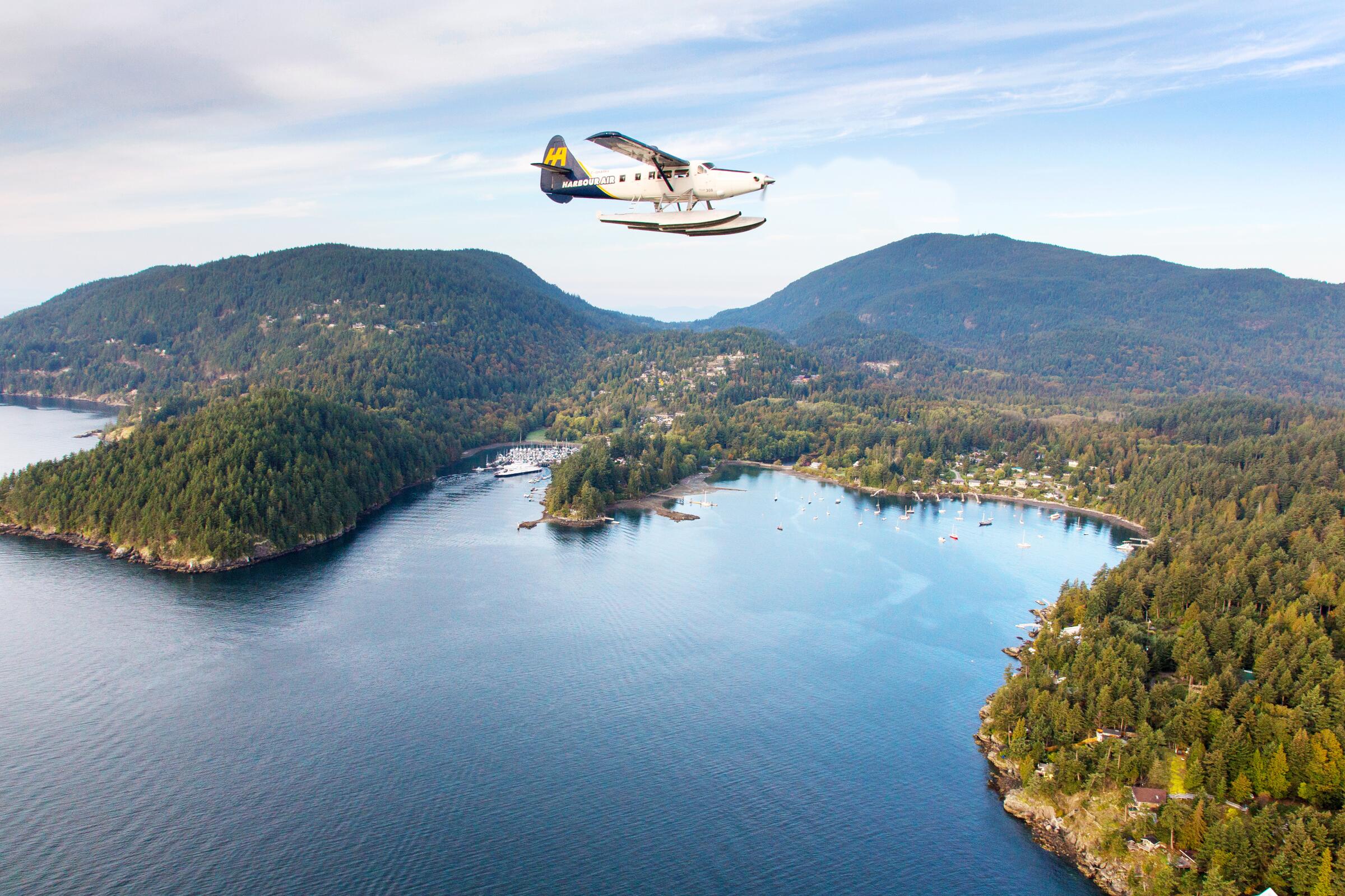
Bowen Island is the easiest island escape from Vancouver, twenty ferry minutes from Horseshoe Bay, and this 28 km loop makes a full day of it. A mix of quiet paved roads and gravel, with about 600 m of climbing and some genuinely rough patches, plus coffee and lunch options in Snug Cove before the boat home.

Stops, map + getting there →
Photo: Harbour Air SeaplanesBowen Island, BC
Bowen Island Day Trip (shorter)
22 km · 485 m up
ChallengingCalm streets, some sharingMixed surfaceChunky gravelMax climbing

The shorter, gentler version of the Bowen Island day trip: 22 km of quiet island roads and gravel with about 480 m of climbing. Same ferry, same island charm, more time for the bakery. A good pick when the group has mixed legs.

Stops, map + getting there →
Photo: Heath MoffattSquamish, BC
Capilano Salmon Run
20 km · 396 m up
AmbitiousComfortable for mostMixed surfaceLots of climbing

An easy 20 km ride tracing the Capilano River through West Vancouver's forest edges, mostly paved with some gravel path. The name is a hint: come in fall and you can watch salmon fighting upstream below the canyon walls, with the hatchery a natural stop.

Stops, map + getting there →
Photo: Jennifer KleingeltinkAgassiz, BC
Deep Cove Ramble
27 km · 411 m up
AmbitiousComfortable for mostMixed surfaceLots of climbing

One of the prettiest rides on the North Shore: 27 km around Deep Cove mixing mossy forest trails, open fields, and flowy singletrack, with one steep hike-a-bike to keep you humble. Mostly gentle otherwise, and Deep Cove's famous doughnuts wait at the end.

Stops, map + getting there →
Photo: Blake JorgensonSquamish, BC
Lakes and Rivers
50 km · 306 m up
ModerateComfortable for mostMixed surfaceSome climbing

A Gravel Buddies favourite: 50 km wandering through parks and along rivers east of Vancouver, nearly flat, with plenty of spots to stop, swim a toe, and picnic. Perfect for a sunny day when the ride is the destination.

Stops, map + getting there →
Photo: Reuben KrabbeNorth Vancouver, BC
North Shore through Stanley Park
37 km · 684 m up
AmbitiousComfortable for mostMixed surfaceLots of climbing

A 37 km link-up of Vancouver's classics: through Stanley Park, over to the North Shore, and back, mixing seawall, forest paths, and gravel with about 680 m of climbing. City riding at its most scenic, with the bridges themselves among the highlights.

Stops, map + getting there →
Photo: Albert NormandinVancouver, BC
North Van Sampler
56 km · 1032 m up
AmbitiousComfortable for mostMixed surfaceLots of climbing

A 56 km sampler of North Vancouver's mixed terrain, stitching gravel paths and quiet streets with over 1,000 m of climbing. The North Shore tilts: expect to work on the way up and grin on the way down.

Stops, map + getting there →
Photo: Vision Event PhotographyVancouver, BC
North Van Shakedown
33 km · 566 m up
AmbitiousComfortable for mostMostly gravelLots of climbing

A 33 km route exploring North Vancouver's hidden neighbourhood connectors, with singletrack, steep climbs, and fast downhills. What goes up comes down, and nowhere is that truer than North Van. Just over half unpaved, and a good shakedown for bike and rider alike.

Stops, map + getting there →
Photo: Michael BednarVancouver, Coast and Mountains, BC
Upper North Van
28 km · 340 m up
AmbitiousComfortable for mostMixed surfaceLots of climbing

An easy 28 km loop through Upper North Vancouver on a mix of leafy streets and gravel paths, with only about 340 m of climbing, gentle by North Shore standards. A relaxed introduction to the area's mixed-surface riding.

Stops, map + getting there →
Photo: Andrew StrainVancouver, Coast and Mountains, BC
Golden Ears Overnighter (out and back)
105 km · 735 m up
AmbitiousComfortable for mostMostly gravelSome climbing

An adventure that starts from your doorstep: ride 105 km out and back from Port Moody to Golden Ears, camp beneath the mountains, and be home for dinner the next day. Mostly flat on a mix of gravel and pavement, it is one of the easiest ways in the Lower Mainland to try a first bikepacking trip without a car shuttle.

Stops, map + getting there →
Photo: Blake JorgensonWhistler, BC
Squamish-Whistler (out and back)
96 km · 1622 m up
AmbitiousComfortable for mostMostly gravelChunky gravelLots of climbing

The Squamish-to-Whistler stretch of the Sea to Sky Trail, ridden as a 96 km out-and-back so no shuttle is needed. The trail follows a corridor Coast Salish and Interior Salish peoples travelled long before the highway, climbing from lush rainforest into pine forest on a mix of flowy singletrack and chunkier wide sections, with clear lakes for swimming and viewpoints all along. About 1,600 m of climbing spread over the day or a night out.

Stops, map + getting there →
Photo: Dolf VermeulenHalfmoon Bay, BC
Sunshine Coast Overnighter
67 km · 1098 m up
AmbitiousRide with trafficMixed surfaceLots of climbing

A 67 km overnight trip on the lower Sunshine Coast starting near the Langdale ferry, mostly on paved roads that roll and climb hard, about 1,100 m in total. Ferry over from Horseshoe Bay, camp partway, and let the coast set the pace. Expect to share the road on the busier stretches.

Stops, map + getting there →

Vancouver Island · 11

Photo: Peter O HaraLadysmith, BC
Rally Day 1 (West Vancouver)
160 km · 1212 m up
AmbitiousCalm streets, some sharingMixed surfaceSome climbing

The first day of the Gravel Buddies 2025 Rally: 160 km from West Vancouver, ferry across the strait included, onto Vancouver Island's mixed gravel and pavement with about 1,200 m of rolling climbing. A long social day built for steady groups; a gentler alternative route runs the same day.

Stops, map + getting there →
Photo: Landon CopplestoneDuncan, BC
Rally Day 1 alternative (West Vancouver)
150 km · 965 m up
AmbitiousCalm streets, some sharingMixed surfaceSome climbing

The alternative first day of the Gravel Buddies 2025 Rally: 150 km on the same West Vancouver-to-island journey with a bit less gravel and about 950 m of climbing. Same destination, slightly kinder legs.

Stops, map + getting there →
Photo: Graeme OwsianskiCobble Hill, BC
Rally Day 2 (Cowichan Valley)
118 km · 795 m up
AmbitiousCalm streets, some sharingMostly gravelSome climbing

Day two of the Gravel Buddies 2025 Rally crosses the Cowichan Valley: 118 km, more than half gravel, with about 800 m of rolling climbing through farm and wine country. A shorter alternative runs the same day for anyone saving their legs.

Stops, map + getting there →
Photo: Peter O HaraShawnigan Lake, BC
Rally Day 2 alternative (Cowichan Valley)
95 km · 652 m up
AmbitiousCalm streets, some sharingMixed surfaceSome climbing

The alternative second day of the Gravel Buddies 2025 Rally: 95 km through the Cowichan Valley with about 650 m of climbing, a little less gravel and a little more mercy than the full day-two route.

Stops, map + getting there →
Photo: Andrea JohnsonSalt Spring Island, BC
Rally Day 3 (Victoria)
96 km · 993 m up
AmbitiousCalm streets, some sharingMixed surfaceSome climbing

The final day of the Gravel Buddies 2025 Rally: 96 km around Greater Victoria with about 1,000 m of climbing, the hilliest day of the three despite the capital setting. A shorter alternative runs the same day. Finish-line coffee strongly implied.

Stops, map + getting there →
Photo: Jordan DyckLadysmith, BC
Rally Day 3 alternative (Victoria)
86 km · 767 m up
AmbitiousCalm streets, some sharingMixed surfaceSome climbing

The alternative final day of the Gravel Buddies 2025 Rally: 86 km around Greater Victoria with about 770 m of climbing and less gravel than the main route. Most of the views, fewer of the hills.

Stops, map + getting there →
Photo: Taylor Cave ProductionsNanaimo, BC
Gabriola Group Ride
23 km · 324 m up
AmbitiousCalm streets, some sharingMostly gravelLots of climbing

A social 23 km gravel ride on Gabriola Island near Nanaimo, rolling past an alpaca and goat farm with an optional detour to the Malaspina Galleries, the island's famous wave-carved sandstone overhang. Mostly unpaved with gentle climbing; built for groups and unhurried days.

Stops, map + getting there →
Photo: Rob WilsonDuncan, BC
Cowichan Valley: Stoltz Pool to Nanaimo
78 km · 417 m up
ModerateRide with trafficMixed surfaceGentle grades

The second leg of a Cowichan Valley crossing: 78 km from the swimming holes at Stoltz Pool on the Cowichan River north to Nanaimo, mostly paved with gravel stretches and about 400 m of climbing. Pairs with the Swartz Bay leg for a car-free island traverse ending at Nanaimo's ferries.

Stops, map + getting there →
Photo: Daniel BaylisShawnigan Lake, BC
Cowichan Valley: Swartz Bay to Stoltz Pool
83 km · 564 m up
AmbitiousCalm streets, some sharingMixed surfaceSome climbing

From the Swartz Bay ferry terminal, this 83 km leg crosses to the Cowichan Valley and follows trail and quiet roads to Stoltz Pool on the Cowichan River, where the provincial park campground and famous swimming holes wait. Nearly half gravel with about 560 m of climbing. Pairs with the Nanaimo leg for a two-day, ferry-to-ferry island crossing.

Stops, map + getting there →
Photo: Taylor Cave ProductionsNanaimo, BC
Gabriola
44 km · 596 m up
AmbitiousCalm streets, some sharingMostly gravelLots of climbing

A 44 km wander around Gabriola Island, a twenty-minute ferry from Nanaimo, mixing trails and quiet island roads, more than half unpaved, with about 600 m of rolling climbing. Beaches, sandstone shorelines, and the island's easy pace do the rest.

Stops, map + getting there →
Photo: Daniel BaylisSooke, BC
Sooke Potholes (out and back)
158 km · 822 m up
AmbitiousComfortable for mostMostly gravelGentle grades

The beloved beginner overnighter: from Swartz Bay, follow the Lochside Trail through Saanich farmland and the Galloping Goose's rail-trail wilderness to Sooke Potholes Provincial Park, about 75 km each way with barely a hill, 95% of it on trail. Camp near the river and spend the evening swimming in the famous rock pools; the park squeezes cyclists in even when sites run out. Bike shops and resupply sit right on the route, and the trail never strays far from help. Bring cash for the campground and a book for the beach.

Stops, map + getting there →
← All route makers
Do you publish well-documented cycling routes in BC — road, gravel, touring, or family rides?

We're interested in learning more about where you love to ride. Drop us a note and tell us what you publish.

hello@bccycletourism.ca