
You've got a trip planned, and the forecast has gone that grey-orange colour. Cancel? Maybe. Here's how to think it through. The forecasting tools are genuinely good, BC is enormous, and a bit of planning usually means changing your trip, not losing it.
Before you commit to a trip plan, answer two questions#
1. Where are the fires, and what's closed? The BC Wildfire Service map shows every active fire and its perimeter. EmergencyInfoBC lists evacuation orders and alerts. If your route passes near an active fire, reroute. No forecast needed for that one. If you plan in Ride with GPS, the same fire picture is available right on the planning map: turn on the wildfire layer (added August 2026) to see active and contained fires, prescribed burns, and estimated perimeters next to your route.
One distinction worth knowing: a fire's perimeter, the official closures around it, and its smoke plume are three different things. A fire can be barely growing while the closures around it stay wide and firmly enforced. Closures are posted by whoever manages the land: area restrictions from the BC Wildfire Service for backcountry areas, BC Parks advisories for parks, Rec Sites and Trails BC for rec trails and forest service roads, and DriveBC for highways. (Evacuation orders and alerts are different again: they apply to communities, and they're what EmergencyInfoBC lists.)
Here's what those tools look like. Every screenshot below was taken the same afternoon (August 30, 2026), and each one links to the live page. Click through and check your own route.
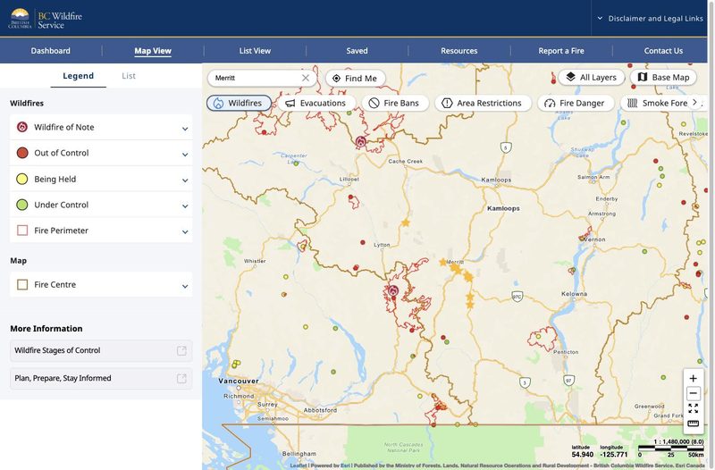
wildfiresituation.nrs.gov.bc.ca/map
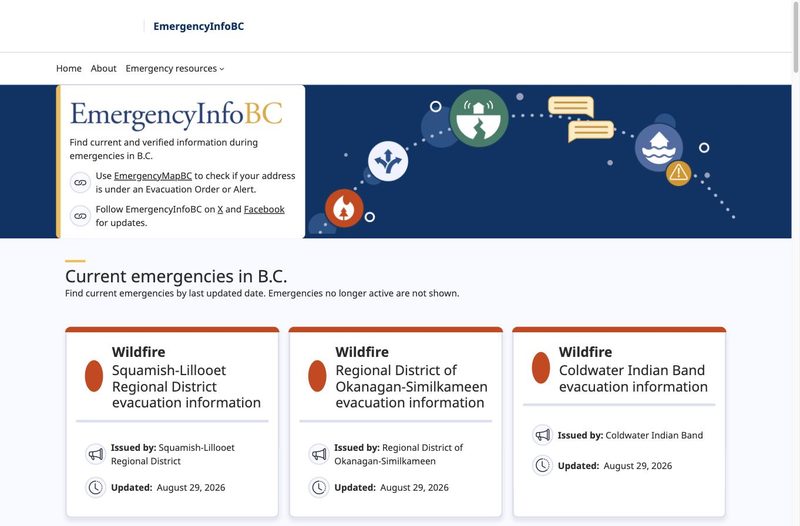
emergencyinfobc.gov.bc.ca

bcparks.ca/active-advisories
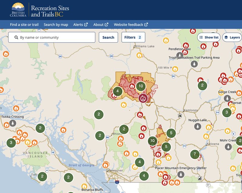
sitesandtrailsbc.ca
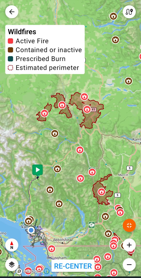
ridewithgps.com
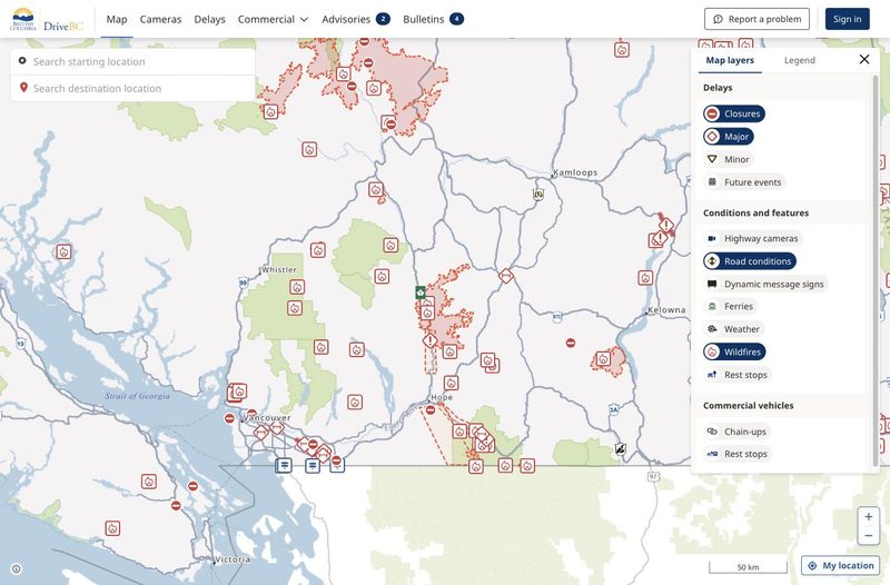
drivebc.ca
2. Where will the smoke be? FireSmoke.ca runs the BlueSky Canada model out of the University of British Columbia (thank you, UBC): an animated forecast of where smoke will be, hour by hour, up to two days ahead. For today's actual conditions, check the Air Quality Health Index (AQHI) for the communities on your route.
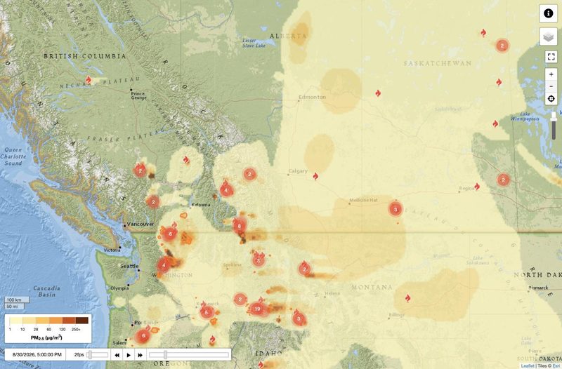
firesmoke.ca
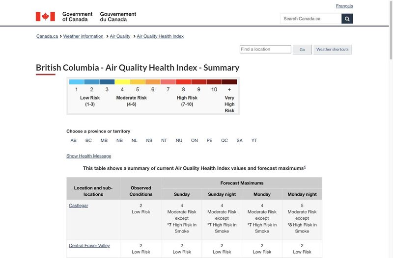
weather.gc.ca/airquality
Should I ride today?#
The AQHI runs from 1 to 10+. The official guidance is written for the general population; here's how we read it for loaded touring, which is strenuous exercise for hours at a stretch:
- 1–3 (low): ride as planned.
- 4–6 (moderate): officially, most people can carry on with normal outdoor activities unless symptoms show up. Loaded and climbing is not normal outdoor activity, so consider shortening the day, easing the pace, or picking the flatter route.
- 7–10 (high): officially, consider reducing or rescheduling strenuous outdoor activity. For a touring day, our read: postpone, reroute, or make it a rest day.
- 10+ (very high): avoid strenuous activity outdoors. Smoke this thick makes it a no-riding day.
If asthma, heart disease, or another condition makes you more vulnerable to air pollution, follow your doctor's advice; the guidance asks people at higher risk to cut back sooner than the numbers above.
Whatever the number says, listen to your body: stinging eyes, coughing, wheezing, a headache, dizziness, or unusual fatigue are reasons to slow down or stop. Repeated exposure adds up too, so don't treat a string of moderate-smoke days as harmless just because no single day crosses a line.
A well-fitted N95 can cut how much smoke you breathe when you have to be out in it.
And don't ride on an old forecast: check the AQHI and the FireSmoke.ca forecast the morning you roll out, and again before a long climbing stretch in case you'll want to slow down or take some extra breaks.
If your plan smokes out: remember BC is big#
When one region is smoky, another usually isn't. Smoke that has settled into the Okanagan may leave Vancouver Island, the Kootenays, or the North clear, and the FireSmoke.ca forecast shows you which. So if the forecast turns before you leave, look at riding a different corner of the province instead of cancelling. Our Plan Your To and Fro pages show which buses, trains, and ferries can carry you and your bike to each region.
Then bookmark the original plan. The route will still be there next year, and a community that spent this summer fighting a fire will usually be glad to see visiting cyclists in a future year when it is rebuilding its economy.
What if it smokes out mid-trip?#
Book accommodation you can cancel where possible. Before you leave, find out which buses or trains serve the towns on your route, so a smoky day 4 is a ride to the bus stop instead of a grind. Download offline maps of a much larger area than your planned route, so you can navigate a detour when a closure appears where cell service doesn't. And check the trail operator's own status page before setting out each day: closures from active fires, like this summer's KVR closure near Trout Creek, show up there first.
One more thing about towns near a fire: even when the road is open, a community preparing for evacuation may need its roads, rooms, and groceries more than a passing cyclist does. If your resupply town is under an evacuation alert, that's a reroute.
Further reading#
Adventure Cycling Association's Bike Touring During Wildfire Season: What to Know and When To Bail (updated July 2026) goes deeper on health thresholds, masks, and when to abandon a trip. Note it uses the US air quality scale (AQI), which runs 0–500 rather than the Canadian 1–10+. For a longer read on how fire seasons are reshaping route choices across the West, Are Wildfires Changing Bikepacking? at bikepacking.com is worth your time.
And our Be Prepared page keeps the year-round checklist: emergencies and cell coverage, conditions, wildlife, and rules of the road.
If you've toured through a smoky BC summer and learned something we missed, tell us and we'll add it.
Accurate as of August 2026. Screenshots taken August 30, 2026; conditions shown are that day's, not today's.